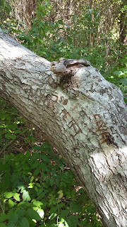
So, onward with our walk. It's a beautiful day today, but rather than go on this walk, I'll just write about it because unfortunately, the sickness that struck me last weekend is still hanging in and heavy physical exertion is not in my repertoire. We left off at the Love Tree (happy belated Valentines Day btw) and were headed up to the view of Nauset Outer Beach.
I only took one snow picture, apparently, though its all gone now. Snow doesn't tend to last on the Cape. We only had a handful of actual cold days before it was in the 50's again and a healthy dousing of rain melted it all away. But I digress...
These two benches overlook Nauset Beach, the inlet that separates ocean from the sheltered marsh, Orleans Cove, and Salt Pond. The wind is always blowing off the water, and you can just hear the waves on the distant beach. This is an amazing place to be during storms, though it is also a place you are NOT supposed to be during storms, for obvious reasons. Let's just pretend I've never been there when I shouldn't be...
I always stop here and just look for a while. It's at the top of a small hill, so it's a nice place to take a rest anyway. There is a large open field opposite the water (which I stood in to take the pictures) that is also beautiful, especially in the summer when it's full of wildflowers, but I forgot to take a picture of it. This time of year, when it's not covered in snow, its a wash of golden brown dead grass with little tufts of milkweed pods clinging in protected spots. When I was a child, I loved going on this walk when the milkweed was out and I could touch the soft cottony seed pods. We would gather the hard outer shells once they were empty and make Christmas ornaments and other artwork with them, My brother and I might have used them as weapons as well, but that's another story.
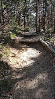
For the next ten or fifteen minutes, its just a quiet, winding trail through the woods. I rarely see anyone else on this part for some reason. I think it might be because most people get to the Nauset Beach view and turn back. And the people who start the walk on the other side tend to do the smaller circle within the larger one, cutting out the woodsy section that I enjoy. I probably love it so much because no one is ever there. Well, someone was, based on the footprints in the snow, but way less people than on the rest of the walk.
The walk bisects the bike path, which always strikes me as a little abrupt, After the quiet and complete woodiness of the past 15 minutes, the slab of pavement always makes me a sad. I cross over it and continue down toward the swamp, and the last little bit of the walk. The return to civilization becomes more evident as the trail crosses a paved service road. Just past the road, there is a choice to go left or right. If you were to follow instructions and read the trail map, it's not really a choice, it's just that I take the long way I'm looking at the middle of the smaller walk. The signs tell you to go left, but I always go right, down the hill into the marsh.
I honestly do not know it's real name, and rather than do the research and find out, I'll just tell you what I've always heard it called: the Blind Trail. The smaller trail goes from the visitor center building in a small loop that only takes about 15 or 20 minutes to do. The entire thing is lined by posts with a rope connecting them, When I was in school they would bring classes of children to this spot, blindfold them, and have them walk it holding onto the ropes, so we could experience what it's like to be blind. None of us took it seriously, we all tripped each other and giggled and peaked through the blindfolds, but I'm very glad my school tried to educate us like that. I doubt children are allowed to miss studying for MCAS long enough to walk in the woods, nowadays.
There are signs throughout the entire area giving the names of trees, but on the Blind Trail, there are informational plaques that talk about the history of the area. They are written in braille as well, seeing as it is the Blind Trail. They mention the Nauset Native Americans who used to live in the area, as well as the original settlers. I never read any of them as a child, but I've since started to take a moment to educate myself as I walk.
Sometimes, I'll close my eyes and hold the rope and see how far I can go without looking. Electrical tape is wrapped around the rope in places to mark where there are steps. Unfortunately, over time, some of the tape is gone, the rope has shifted, and erosion has caused the steps to move. It's a dangerous game to trust the tape.
The last little bit of the walk is a shallow pond that is completely filled with some kind of plant that I can no remember the name of. They are bright red in the summer then turn into sad brown sticks in the winter. Whatever they are, the plaques tell all about them and how there used to be a farm there. A bridge lets you walk out into it. During the summer, its so loud because of the gigantic bullfrogs that you can't even hear the highway, which is not very far away. There are always tons of red-wing black birds there as well, singing.


After the bridge, the trail climbs slowly up a hill back to the visitor center. And that is the walk. It took me 3 blog posts to get it all in there, and I could have gone on, honestly. I didn't even mention the side path that leads to Doane Rock. That's largely because I plan on doing a whole blog about Doane Rock, though I don't plan on walking to it from the National Seashore path. You can drive right up to it, which suits me just fine this time of year.
Thank you so much for walking with me.


